Letter from Amissville
The name “Piedmont” invokes images of the land, specifically the rolling hills forming the beautifully undulating landscape that literally means at the foot (“pied”) of the mountain (“mont”). But the Piedmont is actually defined by water.

Courtesy of Preservation Virginia
Geologically and geographically, the southeastern boundary of Virginia’s northern Piedmont lies precisely at the fall lines of the Potomac, Rappahannock, and James Rivers. Below the falls lies Tidewater Virginia. The Piedmont’s northwestern boundary runs along the Blue Ridge Mountains, from which the headwaters of the Rappahannock and its tributaries spring. (The Potomac and James actually cut through the mountains, so their headwaters are farther west.)
Indeed, the Piedmont’s rich history was determined by its rivers. At the fall lines, where ocean-going ships could travel upstream no further, grew Virginia’s major commercial hubs—Alexandria, Fredericksburg, and Richmond. During the Civil War, the so-called “Rappahannock Line” separated Lee’s Army of Northern Virginia and the Union’s Army of the Potomac. The Battle of the Wilderness, for instance—whose 150th anniversary occurred just this May—took place on the terrain of the Rapidan-Rappahannock confluence.
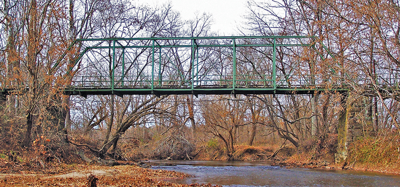
Farther upstream, Kelly’s Ford and other river crossings were the pivotal points for flanking maneuvers and resultant skirmishes, sometimes full-scale battles. One such site, Waterloo Landing, is witnessing a skirmish of sorts today. Its old truss bridge has been closed for safety reasons; should it be torn down or rehabilitated? The battle lines are drawn.
Waterloo Landing was the upstream terminus of a nineteenth-century canal paralleling the Rappahannock and linking Fredericksburg with the upstream Piedmonters. Beginning in 1853, a series of wooden bridges was constructed here. In 1878, the new, durable metal-truss bridge was installed and it still stands today. Considered a significant engineering work, the bridge is eligible for the National Register of Historic Places and is part of the Hedgeman-Rappahannock Rural Historic District nomination that has been submitted to the Virginia Department of Historic Resources.
Although not as historic as the bridge, I’m still ancient enough to confess that some of my fondest boyhood memories, from a time long gone, are entwined with it. It was our favored, seemingly foreign, destination for my friends and I bicycling from Warrenton, fewer than 10 miles away. From the bridge span, we would fish and (probably illegally?) use the rock outcroppings below for BB gun target-practice. Beneath the span, we would swim and launch canoes as we heard the scary, rumbling sound of an occasional vehicle crossing overhead.
Recently I had an opportunity to relive those memories as I floated beneath the bridge on a canoe trip made possible by heavy spring rains. Normally, the upper Rappahannock is much too shallow to run without constantly getting hung up on the river’s ubiquitous rocks. In its shallow, unmuddied waters, you’re reminded that the Rappahannock is one of the very few East Coast rivers unpolluted (except for agricultural runoff) and running freely (with the dam in Fredericksburg now gone).
The Old Waterloo Bridge is much more than an occasion for reverie and nostalgia, however. It contributes to the unique character of the northern Virginia Piedmont. It’s not always the case that human engineering enhances the landscape so. When it does, we should preserve it.
— Walter Nicklin
Leave a Reply